Mt. Daguldul (670+)
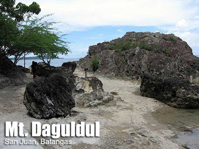 MT. DAGULDUL
San Juan, Batangas
Major jump-off: Brgy. Hugom, San Juan
LLA: 13°40.380N 121°19.160E, 672 MASL (+ 672 m)
Days required / Hours to summit: 1-2 days / 5 hours
Specs: Minor climb, Difficulty 3/9, Trail class 1-3
A nice trek in southern Batangas is the coastal mountain of San Juan, Mt. Daguldul. The name ‘Daguldul’ or ‘Daguldol’ has been used since olden days. It has an onomatopoeic feeling – that of suspense and grandness. Maybe it describes the grandeur of the range and the abrupt rolling of its slopes.Actually a small mountain range, Mt. Daguldul has several ‘gems’ to offer. First, there is the unique seascape that greets the hiker on the intial beach trail. Then, there is trail, moderate in difficulty, passing by woodlands and light forests. In some parts, the greenery is total. Of course there is the peak, which, although not really spectacular in terms of views, has a refreshing feel. Finally, there are excellent sidetrip choices such as the unique Naambon Falls and the acclaimed Laiya beach.
A good thing about Mt. Daguldul is that the guides are organized under the Hugom Environmental Guides Association (HEGA). This means that fees are fixed and they are reasonsable – guides for P400/day and a climbing fee of P30 (as of 2006; update needed). After meeting with the guides or registering, you can start trekking. The trail starts off at the beach – here is where you can see the good rock formations. Afterwards, you will enter the forest. After around 1.5-2 hrs, halfway through the trail, you will see Mang Lizardo’s place; in this area are stores offering basic foodstuffs and softdrinks. Buco juice and even fresh, pure honey can be bought here. Another 1.5-2 hrs and you will reach the peak/campsite areas. Long Henson (2001-2002) was the first to report the names of these campsites, namely Campsite 1 (Gulugod-Baboy); Campsite 2 (Niyugan – lots of cocount trees); and Campsite 3 (Anahawan). Usually, the determining factor in camping is the one you reach before nightfall, but these campsites are all within the area which you can explore anyway.
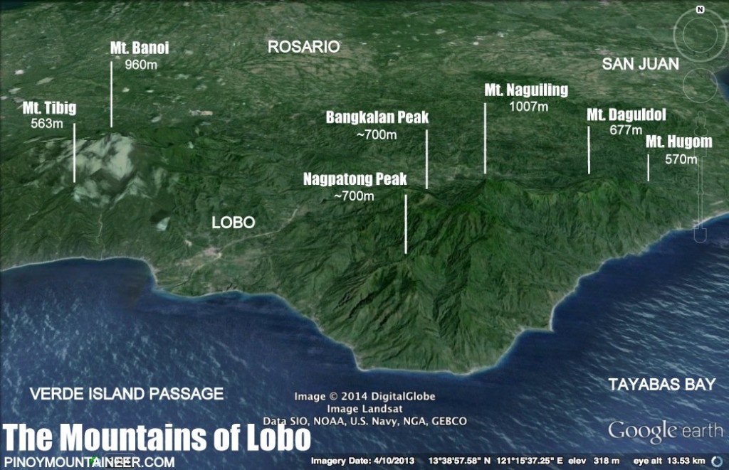
The summit area is windy, as expected from a coastal mountain. Grasslands make for a ‘picnic ground’ feel; there are some rock formations also. In one viewpoint, called Biliran ng Limatik (20 minutes from Niyugan campsite), the nearby mountains such as Maculot (NW), Malipunyo (NNW), and more distant Mt. Banahaw (NE) can be seen; and also Mindoro (and perhaps Verde Island, SE), Tayabas Bay (SW) and a faint island, Marinduque (SSW). Visible also is Naguiling Peak in the same range – a pristine, promising destination.
On the way back, in between Mang Lizardo’s place and the beach, there is a marker that leads to Naambon Falls, just 5 minutes away from the trail. The 25 meters cascade of water falling down a rock face is a must-visit on a trek to Mt. Daguldul. Finally, after the climb, you can unwind in the cool waters of Laiya beach before heading back to Manila.
MT. DAGULDUL ITINERARY
Day 1
0600 Take Lipa-bound bus from Manila (Buendia, Cubao)
0830 At Lipa, charter jeep to Brgy. Hugom
1130 ETA Brgy. Hugom; Arrange for Guides. Lunch
1300 Start Trek – Beach Front
1530 ETA Mang Lizardo’s place
1730 ETA Niyugan Campsite, Set Camp
1900 Dinner / Socials
Day 2
0500 Wake up call
0520 Start Trek going to summit
0540 ETA summit
0700 ETD from summit
0730 Breakfast
0830 Break Camp
0900 Start Descent
1000 Back at Mang Lizardo’s place
1100 Take Naambon Falls sidetrip (1 hr)
1200 Resume descent
1300 Back at Brgy. Hugom; head to beach resorts
1700 Rent jeep back to Lipa or Batangas City en route to Manila
PRACTICALITIES: MT. DAGULDUL
|
Transportation
|
Public (1) Bus, Cubao or Buendia to Lipa [P130, 2 hours] then jeep, Lipa to San Juan [P50, 1 hour] OR direct bus (ALPS) Cubao to San Juan [P200, 2.5 hours]
(2) Jeep, San Juan to Hugom (first trip 0400H; last trip 2000H) [P40, 45 min; charter P800/way] Alternatively: Take Lucena-bound bus to Candelaria, Quezon, Supreme bus to San Juan, then take (3). Private: SLEX>Star>Ibaan exit>turn left to San Juan>Laiya>Hugom |
|
Registration
|
Logbook at trailhead; P35 fee
|
|
Available, required: P400/day
|
|
|
Jeep rental (Rene) – 09127570867
Brgy. Hugom (Kap. Boyet) – 09167664936 |
|
|
Campsites
|
Three campsites including Niyugan and Anahawan near the summit
|
|
Water sources
|
At Niyugan campsite
|
|
Cellphone signal
|
Present in some parts including summit
|
|
River crossings
|
None
|
|
Roped segments
|
None
|
|
None
|
|
|
None
|
|
|
Rattan
|
None
|
|
Hiking notes
|
On the hike itself, consider visiting Naambon Falls (+ 1 hour).
|
|
Sidetrips
|
Laiya beach is a very convenient side trip – resorts cater to different budgets (i.e. P100-150/person). See comments below for rental options.
|
|
Alternate trails
|
A traverse to Mt. Lobo has been reported by other hikers but guides from Daguldol may not be familiar.
|
|
Yes (3-4 hours to summit; 2 hours down); Note: consider private transport if doing a dayhike
|
|
|
850-1150
|
MT. DAGULDOL PICTURES
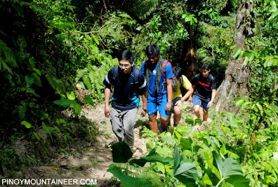 |
| The trail is well-established, passing through woodlands (Mar 2012) |
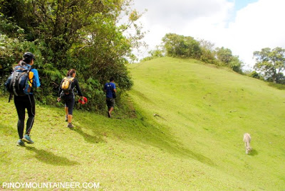 |
| Open grassland slopes near the summit – say hi to the cattle! (Mar 2012) |
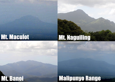 |
| Some of Batangas’ mountains as viewed from the summit (Mar 2012) |
TRIVIA
Biliran ng Limatik, the viewpoint, should suggest the presence of the blood leech but actually they have long retreated to other, deeper regions of the range.
Mt. Daguldul actually bounds two towns, San Juan and Lobo. The latter is also a mountainous area, with Mt. Lobo being its highest peak (948 MASL). New destinations are bound to emerge from this area.
The UP Mountaineers were the pioneering group that led led to the establishment of Mt. Daguldul as a hiking destination in the 1990s.
An account of the blogger’s dayhike up Mt. Daguldol is narrated is Hiking matters #239.
Many thanks to the UP Remondatos, including Dr. Francis Daytec, with whom I first climbed Mt. Daguldul on Oct. 2005. I referred to some websites including a helpful review by Sir Omar jhersey33.multiply.com) and of course Long Henson’s IT to fortify this blog entry. Finally, the cover photo courtesy of Ma’am Ivan Manalansan (ivanulrich.multiply.com ) Many thanks!


Leave a Reply
354 Comments on "Mt. Daguldul (670+)"
hi
share lang po ng experience para sa nagtatanong ng latest about sa mt. daguldol.
noong october 2, 2015 po kami umakyat.
we got there by commuting.
we took ALPS from Cubao to San Juan Batangas (Php198/person), then a chartered a back to back tricycle (Php350/just upto the registration site) from ALPS terminal,may bagyo po kaya hindi kami pinayagan ng nasa registration na umakyat at mag night trek. gabi na po kami nakarating dahil tanghali po ang tapos ng shift nain sa office. So we decided to setup our camp sa pinaka malapit at mura na resort. We were charged Php100/ head, we were a group of 6, to use the spot on the beach inclusive of their kubo’s dining area and the bathroom. The registration fee is Php35 each. We are required to hire a guide for Php450. We cannot spend another night, so it was just a dayhike.
The guide wishes to take us by the beach heading to the jump off but the area is being developed by private resorts so according to the registration lady, they restrict hikers from passing along their perimeter.
So we headed to the concrete, there’s a highway being developed. The highway is not so bad although you will really think of just taking a ride to the jump off as there are jeeps and tricycles passing by, but since we are on a tight budget, it feels better to warm up a good walk before the assault.
The trail is very pleasant, we are a bunch of newbies and we are only with one veteran climber. The resting huts are really well thought of, just when you’re feeling tired you’ll see a hut waiting for you.
We stopped by Kuya Onad’s place and he offered to cook us lunch since we are just doing a dayhike, and said it will be ready by the time we got back. We agreed for a certain amount and promised a tasty Native Chicken Tinola with rice.
We went on to see the two different summits offering different views, one more on the seaside and the other a combi of the seaside and a range im not familiar with. The peaks we went can be distinguisged by the other having a big tree looking like duhat or guyabano. Im not sure. And the other summit having boulders.
And of course after reaching the summit we hurried down to reach Kuya Onad’s place for the tasty tinola and he didnt fail to deliver.
After a good late lunch, we headed back down the trail and we were given a surprise by our guide. We headed to the beach front, claiming that we should just hurry and sneak in sneak out as fast as we can. Of course there was a guard that confronted him but aince we are far from turning back, the allowed us to continue. The beach front seems it originally have corals and shells for it sands but is now being developed and they are obviously importing sand from elsewhere.
When we got back, we need to freshen up so we can head back to Manila. We are being charged Php35 each for use of the bathroom and as we thought it will really not fit our tight budget, our more experienced climber negotiated with the resort owner we stayed the night before if we could just bathe without charging us extra, and the owner was so kind to allow us back in.
We never thought it will be an issue riding out of Laiya back to San Juan, ALPS terminal. goodthing I was listenong to our chartered tricycle when he told us there will be no more trips made getting out until 6pm as well as the ALPS terminal closes the terminal at 6pm. We got his number, so we sent him a text and picked us up near the registration site.
It was too late to take ALPS so we headed to Candelaria, Quezon to wait for a bus that heads back to Cubao. I’d say, the travel time is the thrill of the trip. The charter fee from pcking us up until making sure we made it on the bus is Php700. Pricey? Well imagine taking a tricycle ride from Balintawak to San Fernando. I mean, seriously, it’s almost 2 hours.
We got JAC liner on our way back, (Php189) to Cubao. The experience was really good if you love travelling and good at faloing asleep fast. The place will surely be one of my favorite climbs, and the best part is the experience we earned going in and out of that paradise without the luxury of having your own ride.
Hope this helps!
Gideon. I've been to dagudol before, and we reached the campsite and a "summit" (a peak with a huge boulder). Most blogs i read refer to the campsite as the summit or peak? i am wondering which one is the real summit? Thanks!
Sino po kaya ang umakyat this lately? May balak kasi kaming umakyat this July. Manghihingi lang ng contact details for Barangay, Guide, Resort and Porter. Maraming salamat sa sasagot.
Sino po kaya ang nakapunta sa Mt. Daguldul this 2015? May balak po kasi kaming pumunta. Baka naman pwede nyo kami matulungan hindi na kasi updated yun contact number/person sa Mt. Daguldul. Maraming salamat sa sasagot.
Overpriced ang bayad sa paliligo napakahina naman ng tubig..