Mt. Pulag/Akiki Trail (2,922+)
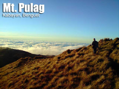 MT. PULAG (AKIKI TRAIL)
Kabayan, Benguet
Major jump-off: Brgy. Doacan, Kabayan (Akiki)
LLA: 16°34’58″N 120°53’15″E, 2922 MASL
Hours to summit / Days required: 10-11 hours / 2-4 days
Specs: Major Climb, Difficulty 7/9, Trail class 3
Please visit the Mountain News (02/21/13) released on PinoyMountaineer.com for the latest on Mt. Pulag.
BACKGROUND
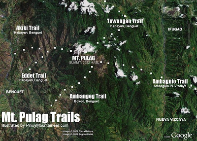
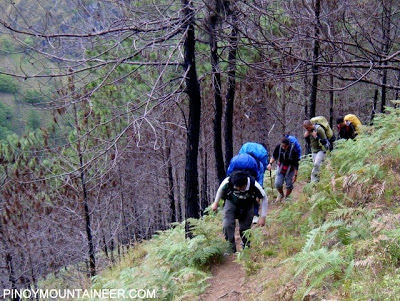
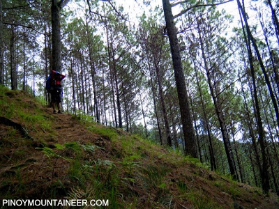
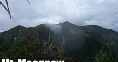
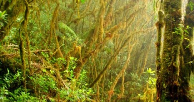
The Akiki trail is a more challenging route to Mt. Pulag, dubbed as the “Killer Trail” by mountaineers because of its steep slopes. It requires 10-11 hours to reach the summit from this trail, whose up-and-down paths pass by Eddet River (2 hours) where one can camp, rest, and bathe, and continuing across steep, scenic pine-covered slopes to what is dubbed as Marlboro Country (4-hours), so-called because its brown, wide landscapes evoke those seen in the cigarette commercials. Just like the other trails to Pulag, this trail would then pass by the montane forest (3 hours) until reach the grassland area. After the challenging trek, the summit views are rewarding, and the saddle campsite affords a closer access to the summit, being just 15 minutes away.
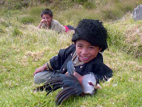 The name of the trail is onomatopeiac in origin, derived from the small brids whose high-pitched chirped sounds like “Aki-ki-ki…”. It is unsurprising that this trail would be named after a bird call, because Mt. Pulag is a bird sanctuary, home to 143 species of birds. Rare species include the whiskered pitta (Pitta koctri) and the Luzon water-redstart (Rhyacomis bicolor).
For more background about Mt. Pulag, refer to the other Mt. Pulag articles in Pinoy Mountaineer.
ITINERARY
(Akiki-Ambangeg with rented jeepney)
Day 0
2300 Bus from Manila to Baguio City
Day 1
0500 ETA Baguio City. Breakfast then proceed to jeepney terminal/chartered jeep.
0700 Take chartered jeepney to Akiki, Kabayan. Early lunch at any stopover.
1200 Arrival at Akiki jump-off; commence trek on steep trail.
1300 ETA Ranger Station. Register. Secure guides.
1330 Start 2-hour trek to Eddet River
1630 ETA Eddet River; set up camp.
1800 Dinner / socials
Day 2
0400 Wake up call. Prepare breakfast.
0430 Breakfast
0530 Break camp
0700 Start 3-4 hr trek to Marlboro Country
1100 Have early lunch at Marlboro country (water source)
1200 Commence 3-hour trek through montane forest.
1430 End of forest line (2600 MASL); Reach Grassland.
1600 ETA Saddle campsite; set up camp.
1730 Assault to summit. Sunset.
1900 Dinner / socials
Day 3
0530 Early morning trek to summit
0545 Arrival at summit just in time for sunrise
0630 Back at campsite; breakfast
0730 Break camp
0800 Start descent via Ambangeg trail
0900 From Camp 2, resume descent to Babadak Ranger Station
1130 ETA Ranger Stn; Settle guide fees; jeepney descent
1230 At DENR-PAO; tidy up and log out.
1400 Head back to Baguio City
1700 ETA Baguio City. Buy return tickets. Dinner.
1900 Head back to Manila
|
General
Disclaimer
|
Please read the Terms of Use for using information in this website.
|
|
Transportation
|
ENTRY
Public (1) Bus, Cubao or Pasay to Baguio City [P460, 6-7 hours]
(2) Rented jeep to Akiki trailhead [P8500 for up to 18 persons, 3-4 hours] or public bus in Dangwa, Baguio City i.e. A-Liner [P150/person, 5-6 hours]
EXIT
Public (1) From Ambangeg Ranger Station, either walk down to Visitor’s Center, take habal-habal, or rented jeep; (2) Continue with rented jeep or take bus back to Baguio; (3) Baguio to Manila by bus.
IMPORTANT: Take note that public bus schedules are very limited – usually just 1-2 trips per day
Private: NLEX>SCTEX>TPLEX>Marcos Highway or Kennon Road>Baguio City then take road to Kabayan via Itogon then stop at the Akiki trailhead. Have your vehicle wait for you at the Ambangeg Ranger Station or the Visitor’s Center if you are exiting via Ambangeg.
|
|
Registration
|
Mandatory orientation and registration at the Visitor’s Center (even if doing Akiki), total fees P225/person plus another registration / additional P50 at the Akiki Ranger Station
|
|
Guides are secured at the Akiki Ranger Station; a system is in place and no prior communication is required. The rate is P1800/guide for 1-8 persons for the whole trip. Porters may also be secured at P1500/for the whole trip.
|
|
|
DENR-PASU (Mereng) – 09196315402
Note: The DENR-PASU has requested PinoyMountaineer not to post numbers of transportation contacts that are not accredited with them. Disclaimer: contact numbers are listed for information purposes only and does not constitute an endorsement of any services. |
|
|
Campsites
|
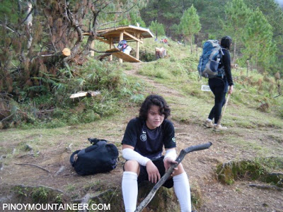
Grassland campsite (Camp II) and Saddle campsite (Camp III)
|
|
Water sources
|
(1) Eddet River
(2) Near Marlboro Country campsite – 20 meters up the trail
|
|
Cellphone signal
|
Present in most parts of the trail, sporadic but present in summit
|
|
River crossings
|
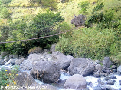
None; There is a hanging bridge over Eddet River
|
|
Roped segments
|
None
|
|
None
|
|
|
None
|
|
|
Rattan
|
None
|
|
Hiking notes
|
The temperature in Mt. Pulag can reach zero or subzero levels especially from December to February; hikers should be prepared for cold weather throughout the year.
|
|
Sidetrips
|
Mt. Tabayoc and the Four Lakes in the far side of the park, other Cordillera peaks.
|
|
Alternate trails
|
|
|
Theoretically yes (7-9 hours to summit; 2-3 hours down via Ambangeg) but logistically difficult if coming from Baguio.
|
|
|
DIY 2500-3000
Guided tours 4000 and up
|
ADDITIONAL CONCERNS
Miscellaneous. You can buy souvenir bonnets (P35) and shirts (P180) at the Protected Area Office. Also, you can leave your group or personal effects (i.e. IDs, pictures, posters) to join the memorabilia displayed at the office lobby. If you wish to have climb certificates, you can print them in advance, leave them before you climb, and pick it up upon signing out.
TRIVIA
There are two schools of thought as to the origin of Mt. Pulag’s name: Some say it is derived from the Ibaloi word ‘pulag’ means ‘to fall down’, reflecting its towering height. Others believe it is from the the Kalanguya word ‘napulogan’ which means bald – referring to its treeless grassland summit. Either way, it is a sacred ground to the locals of the region, to the locals of the region. Animism (worship of natural objects such as trees, animals) still exists in some areas in Benguet, and they believe that ancestral spirits roam in the mountain. This gives rise to Pulag’s being called the “Playground of the gods”.
WEATHER OUTLOOK: KABAYAN, BENGUET



Leave a Reply
343 Comments on "Mt. Pulag/Akiki Trail (2,922+)"
merun po aakyat ngayung feb 18-20?pa sabit naman po.thanks.
Is there anyone doing an Akiki- Ambangeg route on September 12-13? Baka po pwede makisabay (we're just a very small group of 3). Kahit po pa hitch lang sa jeep to and from trail head (We'll pay for our share). Thank you po! – 0915 463 9008
…if may interested din to join Amba-Amba trail on June 13-14, txt me din. Magmemeet yung Akiki group ang Amba group sa saddle ng June 13. 09228428329. Thanks.:)
hi, we are climbing mt.pulag on march 6 via akiki-ambangeg, baka may gusto sumabay to share jeepney? –ninna
Do-it-yourself Mt.Pulag via Akiki Trail
http://www.sabiteers.com/2014/07/do-it-yourself-mt-pulag-via-akiki-trail/